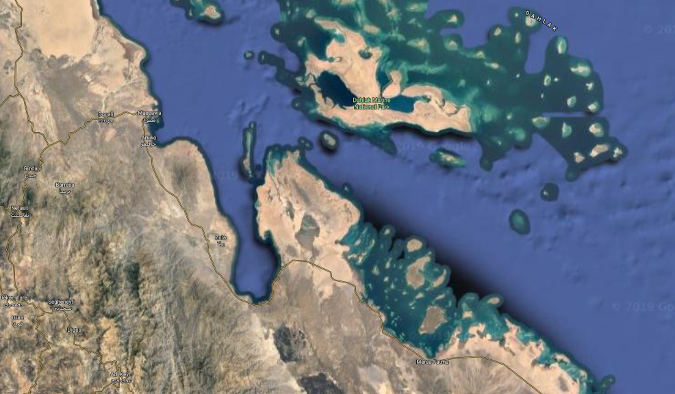
The Buri Peninsula is an area of land in the Ghela’elo Subregion of Eritrea, that juts out into the Red Sea. To its west lies the Gulf of Zula, also known as Annesley Bay, with the village of Arafali at its head. To the north of the peninsular is the Massawa Channel and a group of islands, the Dahlak Archipelago, the largest and closest to the mainland being Dahlak Kebir. To the east of the peninsula lies Howakil Bay, a broad bay, scattered with islands, the largest of which is Howakil Island, and to the south lies a ridge of low hills.[1] The peninsula is generally low and undulating, composed of larva flows at the southern end and granite at the north. It is about 50 km (30 mi) long and 35 km (20 mi) wide, with a constriction 20 km (12 mi) wide in the middle.[2] Further inland to the south are volcanic hills, some conical and others located on ridges, with small sandy plains between them. The highest mountains on the peninsula is Mount Abdur near the west coast and Mount Dureli near the tip. There is a large salt-water lagoon near the middle. Much of the coast is fringed with reefs.[2]
