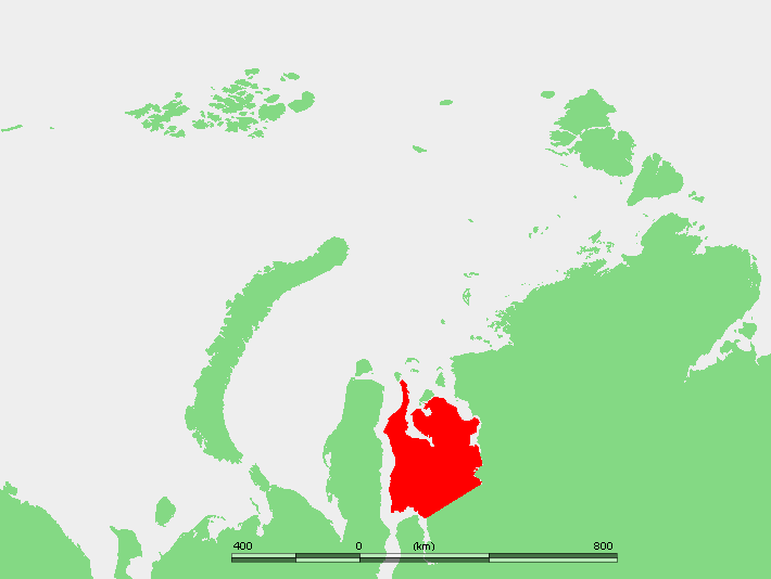
The Gyda Peninsula (Russian: Гыда́нский полуо́стров, romanized: Gydansky poluostrov) is a geographical feature of the Siberian coast in the Kara Sea. It takes its name from the river Gyda, that flows on the peninsula. It is roughly 400 km long and 360 km wide. This wide peninsula lies between the estuaries of the Ob (Gulf of Ob) and Yenisei Rivers (Yenisei Gulf). The southwestern corner of the peninsula is limited by the Taz Estuary. The climate in the whole area of the peninsula is arctic and harsh.
The Gyda Peninsula is mostly flat, with numerous lakes and rivers. River Tanama has its sources in the peninsula.[1] Its ground consists of permafrost and is covered by tundra.
This peninsula has a few arms or subpeninsulas extending northwards into the Kara Sea, where there are some large islands off its shores, including Oleniy, Shokalsky and Vilkitsky Islands. There are two bays in its northern coast, narrow and deep Khalmyer Bay and smaller Yuratski Bay. The peninsula formed between the Khalmyer Bay and neighbouring Yuratski Bay is known as the Mamonta Peninsula (Russian: Полуостров Мамонта; Poluostrov Mamonta, meaning ‘Mammoth Peninsula’)[2] and the narrow peninsula in the NW formed between this bay and the neighbouring Gulf of Ob is known as the Yavay Peninsula (Russian: полуостров Явай; Poluostrov Yavay).
The Gyda Peninsula is located in the Yamal-Nenets autonomous district administrative region of the Russian Federation.[3] It appears also in the genitive as Gydansky or Gydanskiy Peninsula in many common maps in English.
